Showing posts with label wales. Show all posts

Thursday, 22 March 2018

A circuit in the Black Mountains

After a grim period of weather the Met Office served up a compelling weather forecast for a wander onto the hills.


Taking into account the wind direction, likelihood of showers and sunset light, the Black Mountains were chosen and a circuit of Cwm Banw. Nic was enthused enough to accompany me. Ascending through the fields a local farmer was met and a brief chat about the impact of Storm Emma elicited that about 2 feet of snow had fallen and drifted to very impressive depths, all the minor roads were blocked for a few days and it had taken the farmer 15 hours to dig a route to get feed to livestock, a journey that would normally take 5 minutes. To illustrate the severity of the weather event, 2 weeks on there were still snow patches a few feet deep in the sunken holloway on the path up. Reaching the open moorland and sadly the weather changed from blue skies, fluffy white clouds and warm sunshine to more ominous looking clouds, much less blue sky and the donning of winter jackets.

Landforms and patterned vegetation in the Black Mountains


The Black Mountain environs exhibit a curious mixture of landforms from plateau surfaces that suggest relict planation surfaces 10's of millions years old to those attributable with more confidence to repeated glaciations in the pleistocene. Areas of patterned vegetation may be associated with underlying superficial deposits that have been subjected to periglacial processes. Illuminated by more desirable light these would have been more apparent and a mental note was made to revisit at a more optimal time of day and year.

Squall lighting and open moorland


The best lighting occurred on the approach to Pen Allt-mawr where foreground composition was limited to moorland vegetation and a simple demonstration on the why side lighting is preferable for saturated colour.
The approach to Pen Allt-mawr

On reaching the summit of Pen Allt-mawr the squall hit with rain quickly turning to sleet and the novelty of ice coating any exposed clothing. Nic was less than impressed. Still there were grand views to the west until the hill fog obscured everything. I raised the prospect of waiting for the squall to pass and received the look of mutiny from Nic. The planned high level exposed plateau circuit of Cwn Banw walking into wind driven sleet held little appeal and instead we made our way back to the car via a lower, less exposed route. A consultation of the OS map indicated a stream would need to be crossed and that stream would no doubt be swollen. So the return route would keep to a high level and basically contouring, which explains why several relict vegetated periglacial boulder lobes were traversed and on another day these would have presented some photographic foreground interest rather than tiresome obstacles. I feel confident in stating that this particular area is not well visited. Eventually the squall passed, hill fog cleared to make navigation easier and then a brief break in the clouds allowed some sunshine through illuminating the coed cae on the south facing slopes of Cwm Banw and the Sugar Loaf hill in the distance.

A view down Cwm Banw to the Sugar Loaf. 

The stream was easily crossed at a higher elevation whilst lower down the white water suggested very high water flows and probably a more challenging crossing. We made it back to the car just before another squall arrived, a good end to the trip and some locations to be revisited.

Monday, 26 February 2018

An east wind is no good for man nor beast.


The weather forecast for the Brecon Beacons National Park was:

Screen shot from Met Office https://www.metoffice.gov.uk/public/weather/mountain-forecasts/brecon-beacons

The windchill of -10C at 600m something to consider.

Screen shot from https://www.metoffice.gov.uk/public/weather/mountain-forecasts/brecon-beacons


Nic was suitably enthused by the forecast that she decided to accompany me with the enticing prospect of a good walk with late light illuminating the bleached moorland vegetation, rock outcrops and a possibility of twilight alpenglow. A check on other forecasts indicated the wind might well be stronger than the met office forecast and before leaving a check on the visible satellite imagery indicated there was cloud moving across the park from the east. The trip destination would be decided en route determined by the prevailing weather with the Black Mountains, Brecon Beacons and Fforest Fawr all in play. At Abergavenny the Black Mountains were ruled out by cloud and haze. From the highpoint of the A465 the visibility was excellent and the wind very 'fresh', ruling out the Brecon Beacons. Fforest Fawr would be the end destination. The walk was delayed waiting for a helpful farmer to pull the car from less firm ground, sigh, wheel mats under the tyre had proved useless.  However if you were going to get stuck, then this was a good place and time, sheltered from the wind, views, warm sunshine to bask in and a road only used by the farming community who were pro-actively preparing for a sustained cold blast of air from Siberia. After heartfelt thanks and lightening my wallet to reward the good samaritan farmer, I managed to park the car on more firmer ground, not my finest hour and Nic was less than impressed.

Exposed moorland, Devonian sandstone glacial erratic, limestone pavement, sink holes and haze.


Finally underway and on reaching the exposed moorland the wind was a tad stronger than expected, the windchill very noticeable, haze obscured views of the Brecon Fans and haze/cloud bank on the western horizon scuppered any hope of sunset light or alpenglow. A small positive was that the peat bogs were frozen.  A place of relative shelter was sought near a viewpoint and a cunning plan concocted. The plan involved minimising exposed walking and maximising taking in the views from sheltered sites, whilst basking in the warmth of sunshine.

Google satellite view illustrating the density of sink holes.
The area has one of the highest density of sink holes (dolines) in Britain and the geology of limestone, limestone overlain by quartz arenite sandstone and areas mantled by glacial till and peat, means there are good expressions of many sink hole types.

Sink hole (doline) types. Illustration from http://www.bgs.ac.uk/caves/sinkholes/home.html


To successfully photograph the extent of the sink holes requires very low angled side lighting and not for the first time the desired lighting failed to materialise at this location. Nevertheless there were views and limestone pavement to offer some foreground interest and relief from late winter moorland vegetation.


A good walk, decidedly fresh air, geology interest and some moorland visited which would otherwise have been overlooked in better weather.

Monday, 5 February 2018

The clean air of Coed-y-Rhaeadr

After days of wind and rain the weather forecast offered something quieter, still blanket cloud but with the wind easing.  Coed-y-Rhaeadr would be worth a visit with high water flows and there's also something of interest as the area is covered by the Coedydd Nedd a Mellte SAC designated for its old sessile oak woods and ravine woodland. Parking up and a group of walkers arrived back from their outing and were coated with mud to their knees, indicating the paths were in a poor condition.  The enthusiasm for a walking mudfest wasn't that great, so a walk  was made to an area with less footfall i.e sans waterfalls and one that straddles the geological boundary of Carboniferous sandstones (quartz arenites and conglomerates) and underlying limestone lithologies.

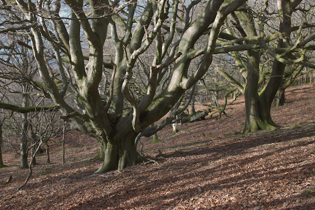
Coppiced oak and pollarded beech tree.

The geology also influences the flora with oak, hard fern (Blechnum spicant), common hair-cap moss (Polytrichum commune) indicating sandstone bedrock, whilst ash, wych elm and sycamore indicate limestone bedrock.
Veteran pollarded sycamore adjacent to a derelict track.


Within the woods there is also evidence for past habitation with long abandoned derelict trackways leading to equally derelict buildings. One substantial pile of rubble was intimately associated with several mature pollarded sycamore trees (neophytes) playing host to a visually impressive covering of native epiphytes including polypody ferns, bryophytes and macro-lichens. A nearby veteran ash tree trunk provided suitable habitat for an old growth forest lichen - Peltigera horizontalis.

Peltigera horizontalis

The attrition of wind and recent snowfall had brought down plenty of lichen covered twigs, branches and trees and in one area a beard lichen - Usnea Florida was conspicuous on the woodland floor and high up in the canopy. A lichen indicator of very low levels of atmospheric pollutants.

Usnea Florida


With dusk approaching the walk was cut short and the end to an interesting wander.

Saturday, 6 January 2018

1st outing 2018

Conscious of the fact that hill walking had been neglected and my fitness levels had dropped alarmingly over a slothful festive period, a trip was needed to the hills. Inspiration was provided by a weather forecast that offered some hope for quality lighting with the caveat of weather warnings and the Brecon Beacons National Park would be the destination. Travelling down the A40 to Abergavenny revealed that the higher ground was obscured by low cloud, sigh, although the cloud was breaking up over the Usk valley. The Black Mountains would offer some relative shelter and the Ffridd/Coed cae potentially the best photographic opportunities given the weather and options to go higher or lower depending on how the weather panned out.


Opting to head first to the higher ground revealed how desperate the weather was, happily common sense prevailed at the futility of making photographs in a decidedly 'fresh' wind, horizontal rain and accompanying hill fog. I later learnt that Met Office weather stations in low lying Herefordshire recorded gusts to 60 mph. So a descent to the relative calm of the Ffridd/Coed cae and a wait for some light to illuminate a magnificent derelict pollarded oak against incoming rain clouds before descending down to an area of woodland that provided an insight into the historic woodland management in the form of low cut pollards and veteran derelict coppice stools. It was then a case of waiting for sunshine to break through the clouds and illuminate the woodland against the backdrop of a dark sky.


Pollarded beech (Fagus sylvatica) and oak (Quercus petraea)


All in all it was a good trip with some welcome low angled light, weather, some fresh air and some much needed exercise.

Saturday, 18 November 2017

"The best laid plans of mice and men often go awry"

Overnight accommodation was booked to enable two days of photography in the environs of the upper Tywi catchment in the Cambrian Mountains. On the journey there plenty of stunning autumnal colour was passed until entering the Twyi valley, where irrespective of the woodland facing aspect or elevation the majority of oak trees were bare of leaves. Hopes of images capturing valleys mantled with autumnal oak canopies juxtaposed against open moorland were shelved for another year. C'est la vie.


The first day was leaden skies. negligible wind and 'damp' so photography ambitions were instead lowered to riparian woodland and the morphology of oak trees contorted by past events and the necessity for leaves to access sunlight. Considering the morphology and growing habitat some of the trees must be of some age.


High annual rainfall, high humidity, relatively low levels of atmospheric pollution and ancient woodland creates an ideal habitat for epiphytic bryophyte and lichens, so the opportunity was taken to photograph some of the more accessible communities.

Barnacle lichen (Thelotrema lepadinum) and Tamarisk Scalewort (Frullania tamarisci)

Crottle (Parmelia saxatilis)

The sunset vigil was spent above the tree line and hopes of a sunset were briefly raised by breaking cloud on the western horizon and then dashed as the breaks closed. Nevertheless the time spent waiting allowed an appreciation of the surrounding plateau surfaces dissected by valleys and exposed bedrock indicated folding on the northern flank of the Tywi Lineament.


The following day saw the wind increase and the weather forecast predicted cloud would briefly break up before closing, a circuitous walk through the woods and up onto the plateau was opted for. The plateau surfaces posed their usual photography challenge: a distinct lack of inspiration, so photography efforts were concentrated down on the plateau slope edge where woodland was naturally regenerating.


The cloud did eventually break up allowing fleeting patches of sunlight to play over the landscape, frustratingly though never the foreground and middle ground simultaneously during a tactical 'rest stop'. Back down in the valley and a viewpoint was chanced upon that I thought held some potential and then discovered the sun didn't quite clear the ridge, sigh.


With incoming cloud negating sunset, there ended the photography and yet another location to put on the list of places to return to one day.


Saturday, 21 October 2017

An autumnal small leaved lime and upland oak wood

A weather forecast for the Brecon Beacons National Park stated fog/mist/low cloud, light rain and negligible wind, so it was with high hopes that I set off for Coed y Rhaiadr, there was fog, negligible wind and light drizzle all the way there until I dropped down to Hirwaun. Where there was no fog, mist or rain and the rotating blades of wind farm turbines indicated wind too. Still there are plenty of options in Coed y Rhaiadr with autumnal colour and I headed for an area of woodland high up the ravine slopes with photogenic veteran oaks. Passing the waterfalls the area is noted for indicated the the tree canopy that provide a backdrop had been stripped of leaves from the recent passage of Storm Ophelia. The oaks I had hoped to photograph were also denuded of leaves, so it was back down to the river.


The numerous waterfalls make it a magnet for photography workshops in the autumn and it hadn't taken long for the workshop providers and punters to stake out their claims. I didn't see anyone photographing the woodland sans waterfalls, which is a pity as the woodland is designated as a Special Area of Conservation. A riparian small leaved lime in autumnal colour provided the necessary inspiration and a native woodland tree that I've rarely found a) in autumn colour and b) suitably sited to make a photograph. From the chosen viewpoint the rain serendipitously broke up the river surface, mitigating the sky reflection. Whilst waiting for the wind to ease I watched a Dipper working its way downstream, diving and feeding from the riverbed. The wind eventually died down to make a photograph and the only audible sound was rain falling and dripping down through the canopy.


Another storm was forecast in a few days time so I made the decision to maximise my photography opportunities and cut short my excursion in Coed y Rhaiadr to visit a nearby upland wood that should have been relatively sheltered from the Storm Ophelia's winds. Some parts of the wood have a closed canopy whilst other parts are more open in nature and mature sessile oaks are spread along a steep sided valley, with crowns and branches shaped by the elements. A few oaks have layered their branches which are mantled with epiphytic lichens and well within tripod height.


Birch, alder, willow, holly, hazel, hawthorn, ash and rowan trees make up the rest of the woodland trees and with more time I would have photographed these, but the oaks were concentrated on for this visit. I do not know anything of the woodlands history, many of the oaks are pollarded and the hazel trees are coppice stools, hinting at a past management regime. The wood is not officially designated as ancient woodland, but is depicted on first edition 19th Century Ordnance Survey maps and some of the oaks appear to be of some age. The lack of regeneration indicates the woodland is overgrazed and has been so for many years.


Eventually the wind and driving rain brought an end to the excursion and a note made to revisit again in the future.

Thursday, 5 October 2017

Upland Peatlands - Photography challenges of moorland


Black Mount hills from Rannoch moor
Rannoch Moor is probably the most photographed upland peatland in the UK, its photographic appeal lies with the changeable weather and hill ranges that form a photogenic backdrop to an extensive tract of blanket bog broken up by bodies of water. Extensive suites of glacial landforms are mantled by blanket bog and the depth of underlying peat and degree of water logging has created a mosaic of vegetation, which has earmarked Rannoch moor for designation as a Special Area of Conservation (SAC). Conveniently it has a major A road that cuts across it for ease of access, it's a great pity that it's an 8 hour drive for me to get there. Nonetheless there are other moorlands and upland peatlands.

Typical moorland scenery of a featureless upland plateau 
Most of the factors that make Rannoch Moor so photogenic are sadly absent from many moorland plateaus. On plateaus the 'high' ground takes the form of long whale backs or shallow domes that provide negligible backdrop. Substantial water bodies are usually man made and glacial erratics are usually absent, leaving vegetation dominating the foreground, middle distance and beyond. The exposed nature makes any wind problematic with subject motion blur. The plateau 'flatness' requires low angled light to provide emphasis and definition to a landscape photograph and preferably some weather too. Taking into account the quality of lighting required to enliven rectangles of moorland and sky, I came to the conclusion some while ago that it's more rewarding to concentrate my photographic endeavours away from the flat moorland plateaus to moorlands that provide more topographic relief.

Rolling moorland
Rolling moorland has some welcome topographic relief to provide depth and a backdrop helps eliminate the land/sky rectangle.


Where foreground interest is confined to vegetation then the vegetation ideally needs to be in bloom or in autumnal colour.  Grasslands hugely benefit from snowfall.


It shouldn't come as a great surprise that panoramic moorlands lend themselves to a panoramic aspect ratios.


Water courses provide an alternative narrative and a welcome addition to moorland scenery.


In a future post I'll cover the challenges of photographing upland peatlands that fall outside the moorland category.


Saturday, 16 September 2017

Upland peatlands - The current state of vegetation and blanket bog

Peat can be sampled and then analysed in a laboratory for pollen, leaves, seeds, roots, stems, insects, charcoal, tephra and radiocarbon dated by scientists to elucidate an environmental and ecological history. It appears that vegetation communities currently growing on peatlands may be unrepresentative of the vegetation communities that formed peat in the past. Two research papers that sampled and investigated peat vegetation in Wales produced compelling evidence to support the change in vegetation growing in upland peatlands.

Mynydd Llangattock ~ Wales
Palaeoecology of degraded blanket mire in South Wales: Data to inform conservation management
Abstract: Many European blanket mires are degraded and contain few Sphagna. In Wales, more than half exhibit symptoms of degradation. We used palaeoecological techniques to chronicle recent vegetation history at two upland localities in South Wales to provide an understanding of the contribution of various factors in mire degradation and to aid wider conservation management strategies. The data suggest a major vegetation change post-dated the start of the industrial revolution. There was evidence for increased burning activity, but as this phenomenon was not present in all profiles it seems unlikely that fire was the principal or sole agent in vegetation change. Rather, increased atmospheric input, plus a change in grazing pressure, may have been responsible. The implications for conservation management are far-reaching. The present overwhelming dominance of Molinia at Hirwaun Common is unprecedented. So also is a local dominance of Calluna, shown in one area at Mynydd Llangatwg. Hence, the approbation often accorded to Callunetum needs to be tempered with the knowledge that its presence in the Mynydd Llangatwg landscape is not long-standing. Indeed, millennial-scale dominance of Sphagnum imbricatum characterizes the earlier record. Its demise and that of Drosera intermedia took place in historical times. Both localities show floristic impoverishment within the 20th Century, with relatively recent single-taxon supremacy. So, conservation management to reduce the current pre-eminence of Molinia would not run counter to long-established dominance; ways to achieve this are suggested. The methods used in this study have wide applicability in mire conservation. 
Frank M. Chambers, Dmitri Mauquoy, Andy Gent, Freya Pearson, John R.G. Daniell, Peter S. Jones, Biological Conservation, Volume 137, Issue 2, 2007, Pages 197-209, ISSN 0006-3207, http://dx.doi.org/10.1016/j.biocon.2007.02.002.

View south from Drygarn Fawr over the Elenydd peatlands ~ Wales

Recent vegetation history of Drygarn Fawr (Elenydd SSSI), Cambrian Mountains, Wales: implications for conservation management of degraded blanket mires 
Abstract: Many areas of blanket mire in Britain display apparently degraded vegetation, having a limited range of ericaceous and Sphagnum species. Data are presented here from Wales from the upland locality of Drygarn Fawr (Elenydd SSSI), which is dominated overwhelmingly by Molinia caerulea. Palaeoecological techniques were used to chronicle vegetation history and to determine the nature and timing of vegetation changes, as an aid to devising conservation management and restoration strategies. Although for the past 2000 years the pollen and plant macrofossil data indicate some evidence for cyclic vegetation change, they demonstrate that here the major vegetation change post-dated the start of the industrial revolution. The palaeoecological data show a greater proportion of Sphagnum than currently. Local extinction of some species (e.g., Myrica gale) apparently took place in Medieval times, but most of the degradation and floral impoverishment apparently occurred during the 20th Century. The implications for conservation management are far-reaching. The overwhelming dominance of Molinia is clearly unprecedented. While it was locally present for hundreds of years, some factor(s)—possibly a change in grazer and grazing regime—encouraged its recent ascendancy in the 20th Century. Consequently, any management attempts to reduce the pre-eminence of Molinia would not be countering an ingrained, long-established dominance. It is suggested that investigation of degraded blanket mires elsewhere by historical and multi-proxy palaeoecological techniques—through multiple, dated cores to track species extinctions and directional vegetation changes—would help ascertain previous mire floras and so indicate a range of restoration targets for mire vegetation. 
F. M. Chambers, D. Mauquoy, E. W. Cloutman, J. R. G. Daniell, P. S. Jones Biodiversity and Conservation September 2007, Volume 16, Issue 10, pp 2821–2846https://link.springer.com/article/10.1007/s10531-007-9169-3 
Across the UK peat has been sampled and a picture has emerged of mire vegetation change in some regions as a response to a combination of postulated factors i.e drainage, air pollution, grazing intensification, grazing regime change, afforestation, climate change and other factors.

Hill ponies and sheep grazing on Gwaun Cefnygarreg ~ Wales

Across the UK there are a number of projects actively restoring degraded peatlands and the following two videos outline a project funded by the EU LIFE-nature programme restoring two areas in North Wales.


The International Union for the Conservation of Nature (ICUN) Peatlands Programme has produced a booklet "UK Peatland Restoration - Demonstrating Success" and is well worth a read. The next post will look at the vegetation and habitats in the UK upland peatlands.

Monday, 4 September 2017

Upland peatlands

The first in a series of posts covering the 'peatlands' in the uplands of the UK.

Peatland in the Brecon Beacons National Park

A generally accepted definition of what constitutes an upland in the UK is the uncultivated land above 250m - 400m in England and Wales, whilst in Northern Ireland and Scotland upland environments can occur at lower elevations. A relief map of the UK is one way of visually representing the distribution of uplands.

Relief map of the UK
By Captain Blood - Own work, CC BY-SA 3.0, https://commons.wikimedia.org/w/index.php?curid=930331
A case could also be made for visually representing uplands by climatic criteria.

http://www.metoffice.gov.uk/public/weather/climate

Wind

http://www.metoffice.gov.uk/public/weather/climate

Rainfall

http://www.metoffice.gov.uk/public/weather/climate


Days of rain
http://www.metoffice.gov.uk/public/weather/climate


Mean Maximum Temperature
http://www.metoffice.gov.uk/public/weather/climate


Mean Minimum Temperatures
http://www.metoffice.gov.uk/public/weather/climate
So on average the UK upland climate is cool, windy and often wet. The rain falls onto ground underlain by predominantly impermeable bedrock lithologies and that causes at least seasonal waterlogging of the overlying soil layer. Water saturated soils create anaerobic conditions and low temperatures reduce biological activity slowing down the rate of organic material decomposition. Once a threshold is passed for low temperature/months of soil waterlogging, organic material starts to accumulate in soil.

View uphill of an exposure of blanket peat and minerogenic surface from fluvial erosion on a moderate hill slope ~ Mynydd Du, Brecon beacons National Park.


Unsurprisingly the uplands also reveal their presence on a soil carbon map.

Ostle, Nicholas & Levy, Peter & D. Evans, C & Smith, P. (2009). UK land use and soil carbon sequestration. Land Use Policy 26:S274-S283. Land Use Policy. 26. . 10.1016/j.landusepol.2009.08.006.


Comparing the organic carbon content of the UK upland soils to European soils highlights their significance and explains why so many walkers in southern Europe wear fabric walking boots.


There are numerous descriptions of what constitutes a peatland in press - varying minimum depths of peat, satisfying a varying minimum criteria of % carbon content covering a minimum area of land. The International Union for Conservation of Nature, UK Committee have taken a pragmatic approach and define it simply as:
Peatlands are areas of land with a naturally accumulated layer of peat. These are formed under waterlogged conditions from carbon rich, dead and decaying plant material. 
The next post will concentrate on the vegetation and habitats that cover upland peatlands.

Rannoch Moor