Showing posts with label brecon beacons national park. Show all posts

Thursday, 22 March 2018

A circuit in the Black Mountains

After a grim period of weather the Met Office served up a compelling weather forecast for a wander onto the hills.


Taking into account the wind direction, likelihood of showers and sunset light, the Black Mountains were chosen and a circuit of Cwm Banw. Nic was enthused enough to accompany me. Ascending through the fields a local farmer was met and a brief chat about the impact of Storm Emma elicited that about 2 feet of snow had fallen and drifted to very impressive depths, all the minor roads were blocked for a few days and it had taken the farmer 15 hours to dig a route to get feed to livestock, a journey that would normally take 5 minutes. To illustrate the severity of the weather event, 2 weeks on there were still snow patches a few feet deep in the sunken holloway on the path up. Reaching the open moorland and sadly the weather changed from blue skies, fluffy white clouds and warm sunshine to more ominous looking clouds, much less blue sky and the donning of winter jackets.

Landforms and patterned vegetation in the Black Mountains


The Black Mountain environs exhibit a curious mixture of landforms from plateau surfaces that suggest relict planation surfaces 10's of millions years old to those attributable with more confidence to repeated glaciations in the pleistocene. Areas of patterned vegetation may be associated with underlying superficial deposits that have been subjected to periglacial processes. Illuminated by more desirable light these would have been more apparent and a mental note was made to revisit at a more optimal time of day and year.

Squall lighting and open moorland


The best lighting occurred on the approach to Pen Allt-mawr where foreground composition was limited to moorland vegetation and a simple demonstration on the why side lighting is preferable for saturated colour.
The approach to Pen Allt-mawr

On reaching the summit of Pen Allt-mawr the squall hit with rain quickly turning to sleet and the novelty of ice coating any exposed clothing. Nic was less than impressed. Still there were grand views to the west until the hill fog obscured everything. I raised the prospect of waiting for the squall to pass and received the look of mutiny from Nic. The planned high level exposed plateau circuit of Cwn Banw walking into wind driven sleet held little appeal and instead we made our way back to the car via a lower, less exposed route. A consultation of the OS map indicated a stream would need to be crossed and that stream would no doubt be swollen. So the return route would keep to a high level and basically contouring, which explains why several relict vegetated periglacial boulder lobes were traversed and on another day these would have presented some photographic foreground interest rather than tiresome obstacles. I feel confident in stating that this particular area is not well visited. Eventually the squall passed, hill fog cleared to make navigation easier and then a brief break in the clouds allowed some sunshine through illuminating the coed cae on the south facing slopes of Cwm Banw and the Sugar Loaf hill in the distance.

A view down Cwm Banw to the Sugar Loaf. 

The stream was easily crossed at a higher elevation whilst lower down the white water suggested very high water flows and probably a more challenging crossing. We made it back to the car just before another squall arrived, a good end to the trip and some locations to be revisited.

Monday, 26 February 2018

An east wind is no good for man nor beast.


The weather forecast for the Brecon Beacons National Park was:

Screen shot from Met Office https://www.metoffice.gov.uk/public/weather/mountain-forecasts/brecon-beacons

The windchill of -10C at 600m something to consider.

Screen shot from https://www.metoffice.gov.uk/public/weather/mountain-forecasts/brecon-beacons


Nic was suitably enthused by the forecast that she decided to accompany me with the enticing prospect of a good walk with late light illuminating the bleached moorland vegetation, rock outcrops and a possibility of twilight alpenglow. A check on other forecasts indicated the wind might well be stronger than the met office forecast and before leaving a check on the visible satellite imagery indicated there was cloud moving across the park from the east. The trip destination would be decided en route determined by the prevailing weather with the Black Mountains, Brecon Beacons and Fforest Fawr all in play. At Abergavenny the Black Mountains were ruled out by cloud and haze. From the highpoint of the A465 the visibility was excellent and the wind very 'fresh', ruling out the Brecon Beacons. Fforest Fawr would be the end destination. The walk was delayed waiting for a helpful farmer to pull the car from less firm ground, sigh, wheel mats under the tyre had proved useless.  However if you were going to get stuck, then this was a good place and time, sheltered from the wind, views, warm sunshine to bask in and a road only used by the farming community who were pro-actively preparing for a sustained cold blast of air from Siberia. After heartfelt thanks and lightening my wallet to reward the good samaritan farmer, I managed to park the car on more firmer ground, not my finest hour and Nic was less than impressed.

Exposed moorland, Devonian sandstone glacial erratic, limestone pavement, sink holes and haze.


Finally underway and on reaching the exposed moorland the wind was a tad stronger than expected, the windchill very noticeable, haze obscured views of the Brecon Fans and haze/cloud bank on the western horizon scuppered any hope of sunset light or alpenglow. A small positive was that the peat bogs were frozen.  A place of relative shelter was sought near a viewpoint and a cunning plan concocted. The plan involved minimising exposed walking and maximising taking in the views from sheltered sites, whilst basking in the warmth of sunshine.

Google satellite view illustrating the density of sink holes.
The area has one of the highest density of sink holes (dolines) in Britain and the geology of limestone, limestone overlain by quartz arenite sandstone and areas mantled by glacial till and peat, means there are good expressions of many sink hole types.

Sink hole (doline) types. Illustration from http://www.bgs.ac.uk/caves/sinkholes/home.html


To successfully photograph the extent of the sink holes requires very low angled side lighting and not for the first time the desired lighting failed to materialise at this location. Nevertheless there were views and limestone pavement to offer some foreground interest and relief from late winter moorland vegetation.


A good walk, decidedly fresh air, geology interest and some moorland visited which would otherwise have been overlooked in better weather.

Saturday, 6 January 2018

1st outing 2018

Conscious of the fact that hill walking had been neglected and my fitness levels had dropped alarmingly over a slothful festive period, a trip was needed to the hills. Inspiration was provided by a weather forecast that offered some hope for quality lighting with the caveat of weather warnings and the Brecon Beacons National Park would be the destination. Travelling down the A40 to Abergavenny revealed that the higher ground was obscured by low cloud, sigh, although the cloud was breaking up over the Usk valley. The Black Mountains would offer some relative shelter and the Ffridd/Coed cae potentially the best photographic opportunities given the weather and options to go higher or lower depending on how the weather panned out.


Opting to head first to the higher ground revealed how desperate the weather was, happily common sense prevailed at the futility of making photographs in a decidedly 'fresh' wind, horizontal rain and accompanying hill fog. I later learnt that Met Office weather stations in low lying Herefordshire recorded gusts to 60 mph. So a descent to the relative calm of the Ffridd/Coed cae and a wait for some light to illuminate a magnificent derelict pollarded oak against incoming rain clouds before descending down to an area of woodland that provided an insight into the historic woodland management in the form of low cut pollards and veteran derelict coppice stools. It was then a case of waiting for sunshine to break through the clouds and illuminate the woodland against the backdrop of a dark sky.


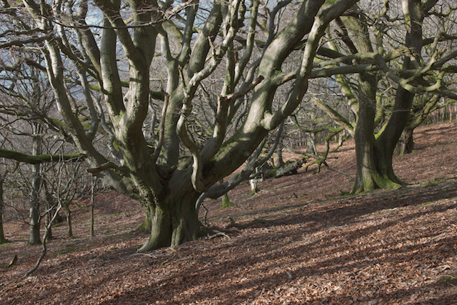
Pollarded beech (Fagus sylvatica) and oak (Quercus petraea)


All in all it was a good trip with some welcome low angled light, weather, some fresh air and some much needed exercise.

Sunday, 20 August 2017

The vagaries of upland weather

The last two trips have perfectly illustrated why it's best to adopt a phlegmatic approach to landscape photography. The first one Nic accompanied me to Y Mynyddoedd Duon (Black Mountains) and a walk up onto and along the Ffawyddog ridge. The walking was enjoyable in warm sunshine with a cooling breeze, heather moorland in bloom and natures larder of bilberries were deliciously sweet.


It became apparent the area encompassed by the Ffawyddog ridge, Vale of Ewyas and Hatterall ridge was a magnet for clear skies, whilst trains of photogenic cloud formations rolled in from the NW further east and to the west over the Gaider Fawr ridge.

Photogenic cloud

I have no great enthusiasm for landscape photography with overhead clear blue skies due to their propensity to drain colour from a landscape and whilst black and white photography would rescue some images it holds no interest for me. When I belatedly decided to explore the moorland vegetation with a macro lens, the wind increased in strength and as sunset drew near a visibly long bank of slow moving cloud appeared to the NW that would mask the best light. The last of the sunlight was utilised for an image of photogenic cloud and then the walk back to the car unassisted by head torch light. The lack of any sunlight on distant hills confirmed the early departure was a wise decision.

The second trip had a rather enticing weather forecast of heavy showers and spells of sunshine with the wind from the SW or the distinct possibility of heather moorland illuminated by fleeting light under stormy skies and the chance of a rainbow. Except the cloud never broke up, towards dusk the rain squalls were heavy and persistent. To be fair the wind strength was spot on with winds of 30 mph (Strong breeze/near gale) and gusts to 40 mph (gale force intensity). The weather and exposed location meant I was relieved to have packed the winter jacket, over trousers and gloves.

Calluna vulgaris and Ulex Gallii

Photography ambitions were restricted to leeward ground and then ground level macro photography before rain curtailed this activity. Chatting to a hill walker descending from a nearby summit it seemed that further south, the cloud was breaking up and sunlight breaking through, this kept me enthused until it became apparent with sunset approaching that this trip would also be curtailed. So two successive trips made where the landscape photography rewards would have been very good if the locations chosen were just a couple of miles distant, c'est la vie!

Monday, 14 August 2017

A trip to a heather moor.

The flowering of heather (Calluna vulgaris) marks the end of a self imposed break from visiting the hills in Wales as the welcome addition of purple hues to the vegetative colour palette of greens and yellows transforms the uplands in late summer.

Eventually a number of weather forecasts aligned to give some confidence to what the weather might be and importantly the words 'excellent visibility' and 'cloud breaking up' were prominent.  The one downside was the wind strength of a northerly 'fresh' to 'moderate' breeze that would induce vegetative movement, although a positive would be the suppression of the resident winged insect population. Suitably inspired and motivated an excursion was made to the National Trust property Mynydd Pen-y-fâl an outlier of Y Mynyddoedd Duon (The Black Mountains) in the Brecon Beacons National Park.

Harebells (Campanula rotundifolia)

The ascent route wasn't the planned one, but the convenient one due to the bracken (Pteridium aquilinum) growth. The relatively low winds, increased warmth and sunshine that characterised the early summer of 2017 were optimal for bracken growth and in places exceeded over 2.0 metres in height. However the weather subsequently reverted to the heavy rain and high winds that have afflicted recent summers in the UK. The adverse weather had collapsed the bracken, obscuring the minor paths, necessitating taking a well trodden route to the hills. The consolation of which was chancing upon a colony of Harebells by the side of the track under bracken.

Heather (Calluna vulgaris) and Bilberry (Vaccinium myrtillus) re-colonising a burned area of moorland.

With height gained the bracken covered slopes changed to open moorland and by mostly keeping to vehicle and sheep tracks, footfall was minimised on the vegetation. The moorland is actively managed for conservation by creating a mosaic of varying aged vegetation, the methods employed appeared to be controlled burning and in the absence of charred material on the ground presumably by cutting or flailing. Whilst heather dominated the moorland vegetation there were areas where other plant communities also put in an appearance : Western gorse, bilberry, grasses, rushes, sedges and bracken.

Western Gorse (Ulex gallii), Bilberry (Vaccinium myrtillus) and wind blown Wavy hair grass (Deschampsia flexuosa)

Eventually the cloud started to break up and allowed some welcome sunlight to play over the landscape.


The one downside of the location at this time of year is the curtailing of last light by the main bulk of the Black Mountains massif and the last of the direct sunlight was used on a less exposed area of moor with a mosaic of moorland vegetation modified by conservation management.

The wind negated any dusk twilight photography and a revisit will be made at some point in less windy conditions.

Tuesday, 30 August 2016

Black Mountains trip report

Bank Holiday weekend and on the Sunday a weather forecast to get enthused about for a late afternoon excursion to the northern escarpment of the Black Mountains. The Black Mountains escarpment is part of the Great Red Edge that runs across the Brecon Beacons National Park, so named due to the underlying Old Red Sandstone bedrock. The Black Mountains have undergone repeated exposure to the action of glacial ice and periglacial processes, yet the plateau areas show little apparent sign of glaciation. Surprisingly, comparatively little research has been published on elucidating the evolution of the Black Mountains landscape. The Black Mountains also held some importance for ancient people, as a number of funerary monuments were built in the adjacent landscape. From some viewpoints on the escarpment a number of Neolithic chambered tombs sited at lower elevations can be viewed and Bronze age cairns also occupy some prominent positions at higher elevations. The reason for the siting of the Neolithic funerary monuments locations remains an enigma.


The plan was to walk along the escarpment, with stops to take in the views and to photograph the expansive views as shower light flitted across the landscape, before looping back over moorland and deciding on where to linger for sunset.
The weather was warm and the ascent made in full sunshine, which made matters unpleasant. When the hill slope eased, unerringly, cloud rolled in and that was the last of the sun for the next couple of hours walking. Stops were made to take in the views from the escarpment, the camera gear was not required. A notable highlight was watching a Kestrel demonstrate its mastery of the wind to quarter the escarpment ridge, at times it hovered a matter of metres away, too close for the binoculars field of view. It was surprisingly warm, even with the absence of sunshine and with a stiff breeze at ~750m ASL, a base layer was sufficient.


A brighter area of sky on the western horizon provided some cause for photographic optimism. However the elevated views were marred by reduced visibility, I guess due to a moisture associated with the low level overhead cloud, whilst lower down below 600m the visibility was good. The air clarity determined where a location for sunset would be and a descent made to an outcrop of bedrock with views.
The nature of the vertical joints/fractures in the bedrock outcrop, appeared to correlate with the orientation of the ridge. It would not be unreasonable to suggest that the geological structure exerted some control on the evolution of the landscape.


The sun did sink into the letterbox of clear sky on the horizon and with overhead cloud, the quality of the resulting light was very good.


Needless to say it was a good trip.

Monday, 29 August 2016

A dawn trip to the Brecon Fans

The Met Office served up a reasonable forecast and a trip implemented.


The ticket machine at the National Trust Cwm Gwdi car park provided a time check of 04.04 hrs, surprisingly I had not dithered and no delays on the journey, meant I was well ahead of schedule. Which was just as well as I managed to miss the feint path I needed to take in the valley wood and continued instead on a more easier to follow trail into the bracken clad lower slopes. Recent high winds had flattened the bracken, obscuring trails and resulting in me thrashing my way through it, until reaching the open hillside. The small consolation of the steepness of the hillslope meant I witnessed several shooting stars, aided by the fact that there was no cloud.
Aside from contrails an almost cloudless sky.

The lack of cloud was disconcerting, the prospect of clear skies and cool blue shadows is not an appealing one. A record shot was made of the absence of cloud over much of mid Wales, to be fair there appeared to be a bank of cloud over the distant eastern horizon, which meant the quality first light would be compromised.


Things panned out pretty much as anticipated, the predawn twilight resulted in some wispy cloud and contrails turning pink, the quality first light went missing in the cloud on the eastern horizon and some warm light provided some relief for an image of the heather moorland with contrails some relief against an uninspiring sky. Sigh.


A wander ensued and a nice scene was found of a Rowan tree surviving against the odds of sheep grazing and storms, with the Brecon Fans as a backdrop and some potential for a future trip. Then it was back to the car, reflect on the importance of a sky for a landscape photograph and not for the first time reflect on how inaccurate Met Office forecasts are for dawn.

Tuesday, 26 July 2016

The Brecon Fans trip report

Sometimes in the nadir of midsummer photography inspiration a weather forecast is served up that is compelling enough to motivate me to go forth.
MetOffice weather forecast

With an azimuth of sunset to the north of west, the Brecon Fans were the destination of choice and the prospect of photographing the headwalls of glaciated Cwms in late low sunlight was an enticing one and the basis of a plan.

Imbricated angular boulders in Nant Gwdi


Parking up at the NT car park in Cwm Gwdi and there were a surprising number of cars and a number of sweaty walkers who were hastily unsuiting and debooting to avoid the miasma of flies drawn in by sweaty clothing and flesh. The NT have produced a waymarked walk the Cwm Llwch Horseshoe and the reason for the bedraggled appearance of the walkers was probably the last few kilometres walking on hot tarmac! I am guessing the walk was devised by someone responsible for path maintenance, rather than a hill walker.

Thyme and Yellow Rockrose = Lime rich soil


A quick exit from the carpark and up onto the open hillside. With height gained it was soon apparent that incoming altostratus cloud was spread across the western horizon and would curtail photographic ambitions of the big views for sunset, sigh. Plan A was abandoned and the spurs, slopes and cwms investigated instead. Most of the geology is acidic, but where where the underlying geology was calcretes or calcerous mudstones: celciophile flora was present.

Woolly fringe-moss colony on mineral spoil @~540m asl 
Quarrying activity was evident where sandstone beds had been exploited for stone roof tiles, whilst at other sites I wonder if an archaeological dig might throw up a surprise.

Brecon Fans
A break in the cloud sheet allowed some sunlight through and a blue sky as a partial backdrop to the Fans, before the cloud sheet again dominated the sky, the light was still too harsh though. The best that can said of the trip was a walk around less frequented areas of the Brecon Fans and surprisingly high numbers of sheep grazing.

Wednesday, 9 September 2015

The colour of late summer

A moorland with heather in flower is a fine sight and worth making the effort to wander around and photograph, though a breeze is welcome to keep the midges at bay. On this trip to Y Mynyddoedd Duon, there was thankfully some wind around and the rain showers were light, which combined with a north westerly wind meant visibility was very good.
I would have preferred the views to the north, but the nature of cloud breaks meant only ground to the south received mottled sunlight, one of the vagaries of upland areas affecting cloud formations. Still, the views to the south are not too bad.


The moorland is also being actively managed again, with numerous small areas of burning to clear away 'leggy' heather and encourage new growth. I'm guessing it is habitat management for red grouse and other upland birds, as the scale of burning is nowhere near that of managed grouse moors of shooting estates. The moorland hereabouts still has grasses, bilberry, gorse and fern, which create a richer more varied habitat and pioneer trees are also starting to spread, mostly Rowans, with a few Birch and the odd conifer from nearby plantations.

Towards sunset the wind strengthened, the cloud visibly clearing and breaking up quickly, the prospects for dusk were not promising. Also the way back would be slow going down steep and rough ground under head torch light, it seemed prudent to make the most of natural light to ensure a safe return to the car. I still harbour hopes of one day photographing a heather moor under 'colourful' clouds at dusk.


Saturday, 1 August 2015

A short and wet trip on the moor

The forecast was poor even by the standards of recent weather and yet a small glimmer of hope in the Met office forecast for the Brecon Beacons NP, with a possibility of some broken cloud later in the evening and more probably low cloud, hill fog, heavy showers, strong wind gusts that would provide some atmosphere. The wind direction pointed to high ground in the SE for offering any views and the potential for any burst of sunshine, with cloud breaking up over the Usk Valley. The Blorenge was promising, more so with its car park at 500m asl minimising any uphill slog and I could cope with the elements in lieu of ascent, for a wander around the moorland and take in the 'atmosphere'.

Parking up facing into the wind and the forecast was spot on - cloud base/hill fog was below the bonnet and the windscreen indicated heavy, angled, rain. Still if the cloud broke, after a passing rain band there could be an opportunity for a rainbow, so, on with the rain gear and off into the murk on a decent track across the moorland, then off piste onto sheep tracks for a look around.  Disappointing to note the heather was not in full bloom, but the bilberry leaves were taking on some colour, the berries were ripe and very tasty, a welcome distraction from the weather. A couple of hours wandering and waiting between showers and watching the cloud base rise and lift, but never convincingly clear the 600m level so only the flanks of the Black Mountains were visible and only the Sugar loaf summit occasionally visible.


The Usk Valley around Kemeys Commander has a suite of landforms associated with down wasting glacial ice and the views from the Blorenge provided an idea for an image and viewpoint of the landforms and time of year, one for the increasing list of 'must visit in the future'. On the way back to the car, finally the cloud broke briefly to let weak sunlight through and illuminate the moor, fortunate really as there was a combination of low level and a high cloud. A couple of images made at different angles of view and that was the end of the outing.

Monday, 29 June 2015

Another wild camp

Garreg Las is a minor summit on Y Mynydd Du, with extensive areas of glaciated pavement and periglacial landforms, a geology map shows an interesting outcrop pattern of geology and faulting, The OS map shows some topographic relief, open access upland and the time of year with the azimuth of sunrise to the north of the Carmarthen Fans. All in all sufficient inspiration for a wild camp trip to explore the dusk/dawn potential with a reasonable forecast and good visibility.

A window into the Y Mynnyd Du geology and faulting @ British Geological Survey

Parking up and it was good to see an absence of litter and information boards installed, even the limekilns and quarries were receiving some TLC, part of the Calch project on the areas long history of Lime production. The walk in was warm and I ended up pitching the tent near a small 'peat' pool on the NE flank of Foel Fraith, the level mossy turf almost negated the benefit of an inflatable mat. With the tent pitched, myself foddered and watered, I made my way over to Garreg Las, to record the geology and see what unfolded for sunset.
Foundered glaciated pavement

The sandstone outcropping on Garreg Las, is classed as a quartz arenite, a hard, durable sandstone and its competence is indicated by the outcrop exposure. Large areas show evidence of being scoured and quarried by glacial ice and there is evidence for periglacial processes breaking up the pavement and movement of loose material downslope into lobes and sheets. In places the quartz sandstone has foundered, presumably where the underlying limestone has dissolved away. Erratics resting on the foundered rock point to collapse after deglaciation.
Weathered surface

The sandstone pavement on the western side, appears extensively weathered, there is an absence of fresh striae and chatter marks and intriguingly there are some sizeable weathering pits/pot holes, landforms I have also seen on bedrock in the hills of the Cairngorms and Norway. It is thought that the formation of weathering pits is an erosion phenomena associated with high wind and the scouring or abrasive action by loose rock/grains and water. Field studies in the Cairngorms revealed limited formation of weathering pits/pot holes in recently glaciated areas and deeper weathering pits were confined to relict surfaces. Cosmogenic radiation dating of the Cairngorm bedrock surfaces with weathering pits revealed an exposure age range of ~ 21,000 - 79,000 years for glaciated areas and ~50,000 - 250,000 years exposure age for unglaciated areas. The vertical joint/fracture surfaces also displayed 'cavernous' weathering on the west side of Garreg Las, whereas I didn't notice any weathering on vertical surfaces on the eastern side, features that suggest two episodes of pavement break up. To my eyes, the weathered appearance and presence of weathering pits does suggest that some surfaces on Garreg Las have been exposed for a long period of time, on the other hand, it may just be a less competent area of sandstone.
Weathering pit 

The summit of Garreg Las, Twyn swnd, is adorned with a pair of large bronze age cairns, Carnau'r garreg las, and visible on the skyline from a number of directions, mostly from higher ground/upland areas.
Carnau'r garreg las
I'd hoped for a view to the north for sunset, but haze reduced visibility and on the NW horizon a solid band of cloud was evident with streamers of cirrus clouds. I was also beginning to question my wisdom at leaving a tele zoom out of the bag. Considering the options I headed back downslope to an area on Cefn y Garreg Las where there were some larger erratics and an area of flowering bog cotton.


Weak sunlight and Incoming cloud at sunset
Returning to the tent, I reflected on my inability to find a composition on Garreg Las that convincingly illustrated a down faulted block of younger geology against older geology. I made a note that the geological faulting of Garreg Las, would probably be better photographed later in the year towards the winter solstice using the low angle of light to model the geology and from a viewpoint elsewhere on Y Mynydd Du. Still, there was the promise of dawn and a view of the Welsh Borderland Fault System to north.
Sunrise
A look out the tent in the gloaming of dawn revealed the depressing sight of clear skies overhead and to the south, with a band of cloud to the north and north east. The 3rd successive photography trip at dawn with clear blue sky overhead and the sun rising into cloud, deep sigh. So, twilight photography bite the dust for a start, sunrise seemed destined to follow suit and when the sun eventually cleared the cloud, any shadows would be an unappetising blue shade, the colour cast courtesy of the overhead clear sky, not the best as grey rock would really accentuate the 'blue' shade. I had a dark suspicion that the band of cloud responsible for masking sunset, was the very same cloud mass which would now obscure sunrise. Still there was some mist around in the valleys and pretty good visibility, which gave some hope.
100mm field of view of Welsh Borderland Fault System

Reaching the northern slope of Garreg Las and a look out to the NE horizon gave confirmation that there would be no warm side lighting at sunrise.  Things looked more positive to the North with colour in the clouds and valley mist highlighting the Welsh Borderland fault system. I now wished I'd packed a telephoto zoom, as 100mm was too wide on the vertical angle of view and needed a vertical crop to get the view sans foreground. The Welsh Borderland fault system delineates a terrane boundary separating the Cymru and Wrekin terranes, stretching from Pembrokeshire to Shropshire.
Desired crop


On up into the boulder field and with neutral coloured rock, I really would have liked the warm light of sunrise and cloud overhead. Instead it was matter of trying to find a view that showed the extent of the periglacial breakup and mass movement of debris downslope and keep enough warm light rock to offset the blue shade.


A powder blue sky and harsh summer light, meant my inspiration dried up shortly afterwards and it was a case of recording some geology outcrops on the way back to the tent and the journey back home reflecting on events.